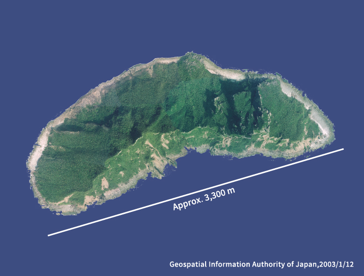
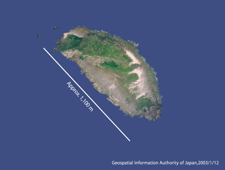
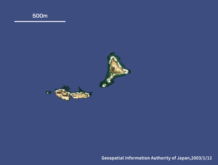
| Area | 3.81k㎡ |
|---|---|
| Location | Latitude 25º44´ N, Longitude 123º28´ E 170 km northwest of Ishigaki Island (westernmost point of the Senkaku Islands) 2392, Tonoshiro-Senkaku, Ishigaki City, Okinawa Prefecture |
| Altitude | 362m |
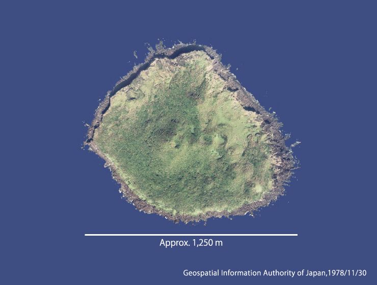
| Summary | In the archipelago, this is the largest island with a long oval shape extending east to west. The north side of the island has relatively gentle slopes from the coast to the summit of the mountain, while the south side is formed of steep cliffs. |
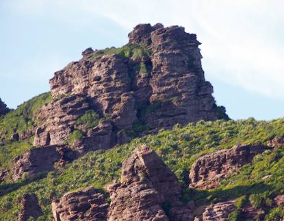 Photo courtesy of Yoshihiko Yamada
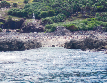 Photo courtesy of Yoshihiko Yamada
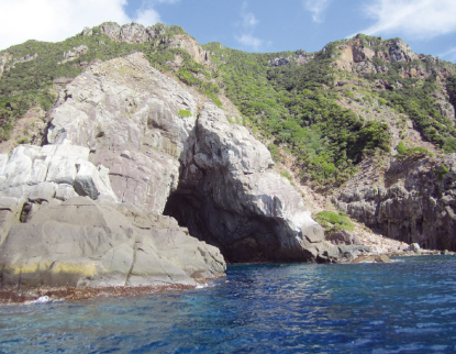 Photo courtesy of Yoshihiko Yamada
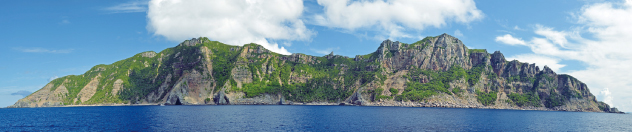 Photo courtesy of Tokyo Metropolitan Government
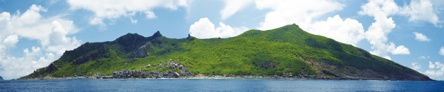 Photo courtesy of Tokyo Metropolitan Government
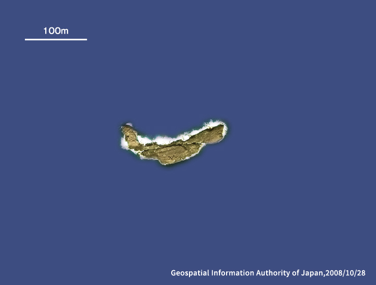
| Area | 0.91k㎡ |
|---|---|
| Location | Latitude 25º55´ N, Longitude 123º40´ E 182 km north of Ishigaki Island, 22 km northeast of Uotsuri Island 2393, Tonoshiro-Senkaku, Ishigaki City, Okinawa Prefecture |
| Altitude | 117m |
| Summary | Also known as “Kobi-sho,” it is an almost circular volcanic island with several craters in the center. The terrain gently slopes downward from the island’s central part to the seashore, whereas the coast is surrounded by precipice rocks. |
| Area | 0.06k㎡ |
|---|---|
| Location | Latitude 25º55´ N, Longitude 124º33´ E 180 km northeast of Ishigaki Island, 103 km east of Uotsuri Island (easternmost point of the Senkaku Islands) 2394, Tonoshiro-Senkaku, Ishigaki City, Okinawa Prefecture |
| Altitude | 75m |
| Summary | Also known as “Sekibi-sho,” Taisho Island is located at the eastern end of the continental shelf. It is comprised of a thin main cliff rising perpendicularly in the direction of east to west and several low elevation cliffs. |

| Area | 0.31k㎡ |
|---|---|
| Location | Latitude 25º43´ N, Longitude 123º32´ E 166 km northwest of Ishigaki Island, 160 km north of Iriomote Island 2391, Tonoshiro-Senkaku, Ishigaki City, Okinawa Prefecture |
| Altitude | 125m |
| Summary | This rectangular island has four protruding corners. The northern part consists of rocks with pointed edges, and the southern part has a rocky terrace hill. Elevated coral reefs surround the island. |
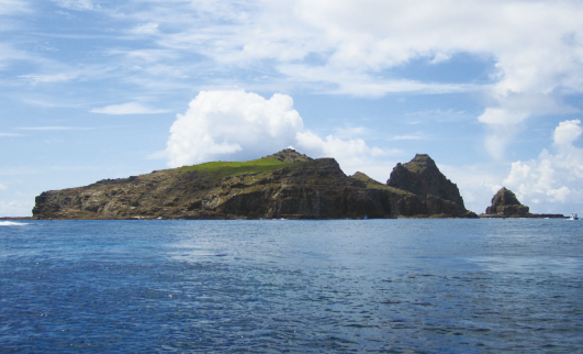 Photo courtesy of Yoshihiko Yamada
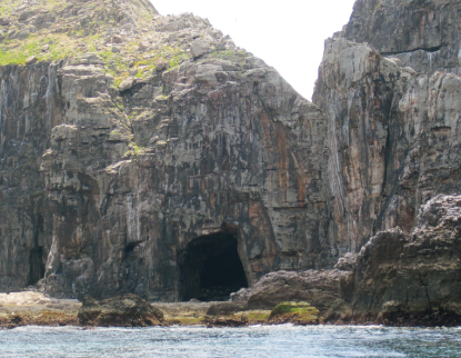 Photo courtesy of Yoshihiko Yamada
| Area | 0.40k㎡ |
|---|---|
| Location | Latitude 25º43´ N, Longitude 123º33´ E 165 km northwest of Ishigaki Island, 160 km north of Iriomote Island 2390, Tonoshiro-Senkaku, Ishigaki City, Okinawa Prefecture |
| Altitude | 139m |
| Summary | This island consists of two areas with sharp pointed rocks, with flat ground of elevated coral reefs stretching between them. The whole island has an oval shape. |
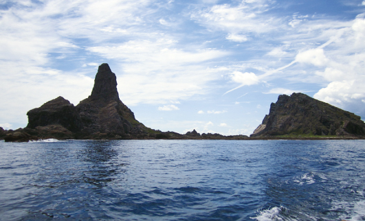 Photo courtesy of Yoshihiko Yamada
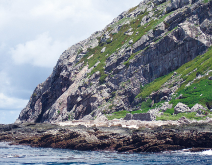 Photo courtesy of Yoshihiko Yamada
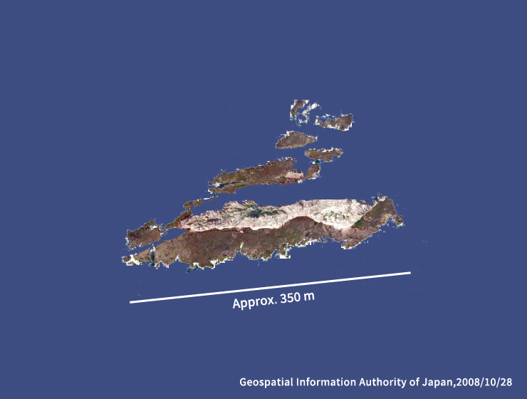
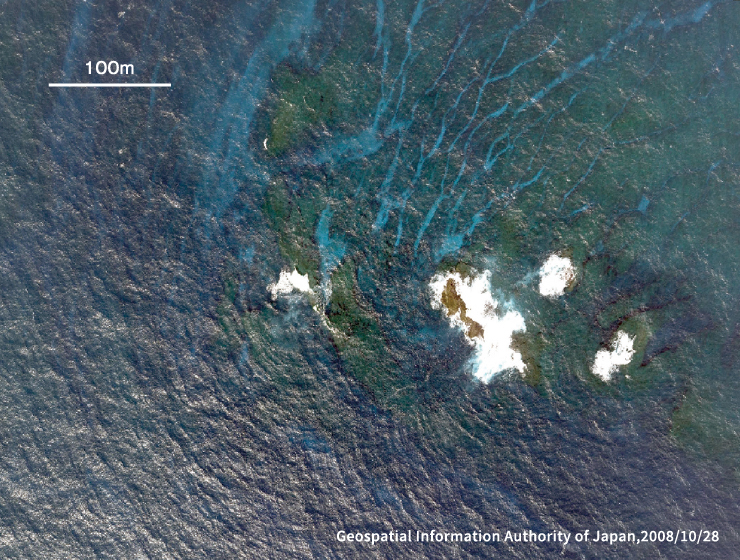
| Area | 0.03k㎡ |
|---|---|
| Location | Latitude 25º46´ N, Longitude 123º32´ E 170 km north of Ishigaki Island |
| Altitude | 28m |
| Area | 0.01k㎡ |
|---|---|
| Location | Latitude 25º45´ N, Longitude 123º34´ E 167 km north of Ishigaki Island |
| Altitude | 10m |
| Area | 0.002k㎡ |
|---|---|
| Location | Latitude 25º44´ N, Longitude 123º30´ E 167 km northwest of Ishigaki Island |
| Altitude | 2m |